Access Management
Controlling where cars can enter and exit roads to reduce conflicts and make traffic flow more smoothly.
 Clarkston Safe Streets and Roads for All
Thank you for participating in these online engagement activities for the Clarkston Safety Action Plan! The exercises below focus on draft recommendations for both the overall City of Clarkston and the North Indian Creek Drive/Montreal Road Corridor specifically:
Please take time to review the information under both tabs and offer your feedback. We appreciate you supporting this important project!
Controlling where cars can enter and exit roads to reduce conflicts and make traffic flow more smoothly.
Parts of the sidewalk which extend into a crossing, allowing drivers to see pedestrians more easily and shortening crossing distances
An entire intersection raised to the height of the sidewalk, allowing drivers to see pedestrians more easily and forcing vehicles to slow down
A paved path alongside the road where people can walk safely, separate from cars
Bike lanes with extra painted space, and possibly a physical barrier, between bicyclists and cars, providing more room and comfort for bicyclists
Bright green markings painted on the road to clearly show where bike paths are, helping drivers notice cyclists
A pedestrian-activated light designed to alert drivers or to stop traffic for pedestrians in crosswalks
Traffic signals with reflective borders, allowing them to be seen more easily
Roadway features that realign travel lanes in a staggered pattern, slowing traffic without restricting access
A raised island in the middle of a wide road where pedestrians can stop and wait before continuing to cross
Redesigning a road to have fewer or narrower car lanes, making room for bike lanes, sidewalks, parking, or turn lanes, which slows traffic and makes crossing easier
A set of safety improvements at an intersection, likely to include improving visibility and reducing speeds
More complex safety improvements specific to a single location See recommendation text for further detail
Lights specifically placed to brighten sidewalks and crossing, helping both pedestrians and drivers see each other at night
A circular intersection that guides traffic around a center island, limiting how and where vehicles interact with each other
Signs that alert drivers to upcoming hazards, like curves, pedestrian crossings, or changing road conditions
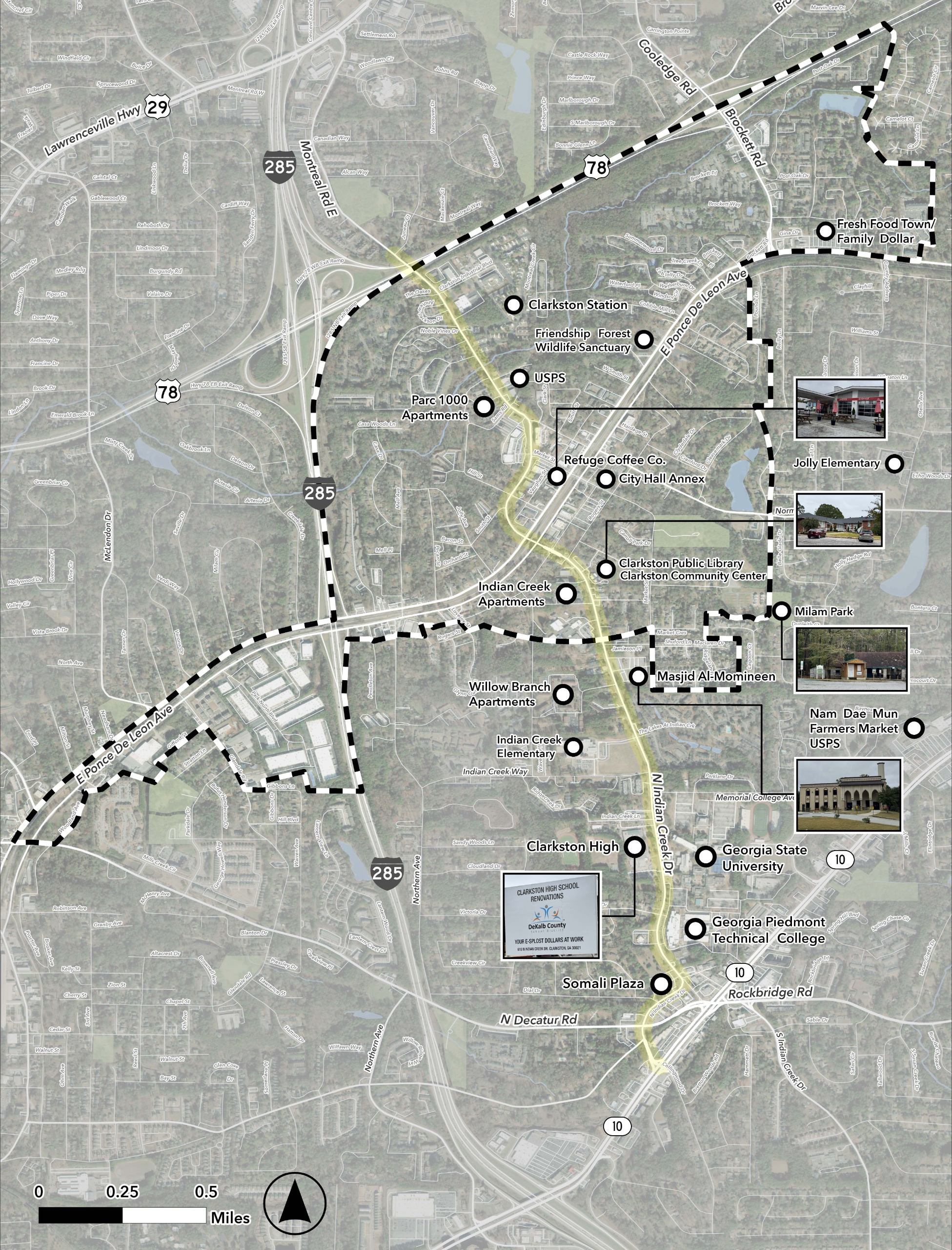
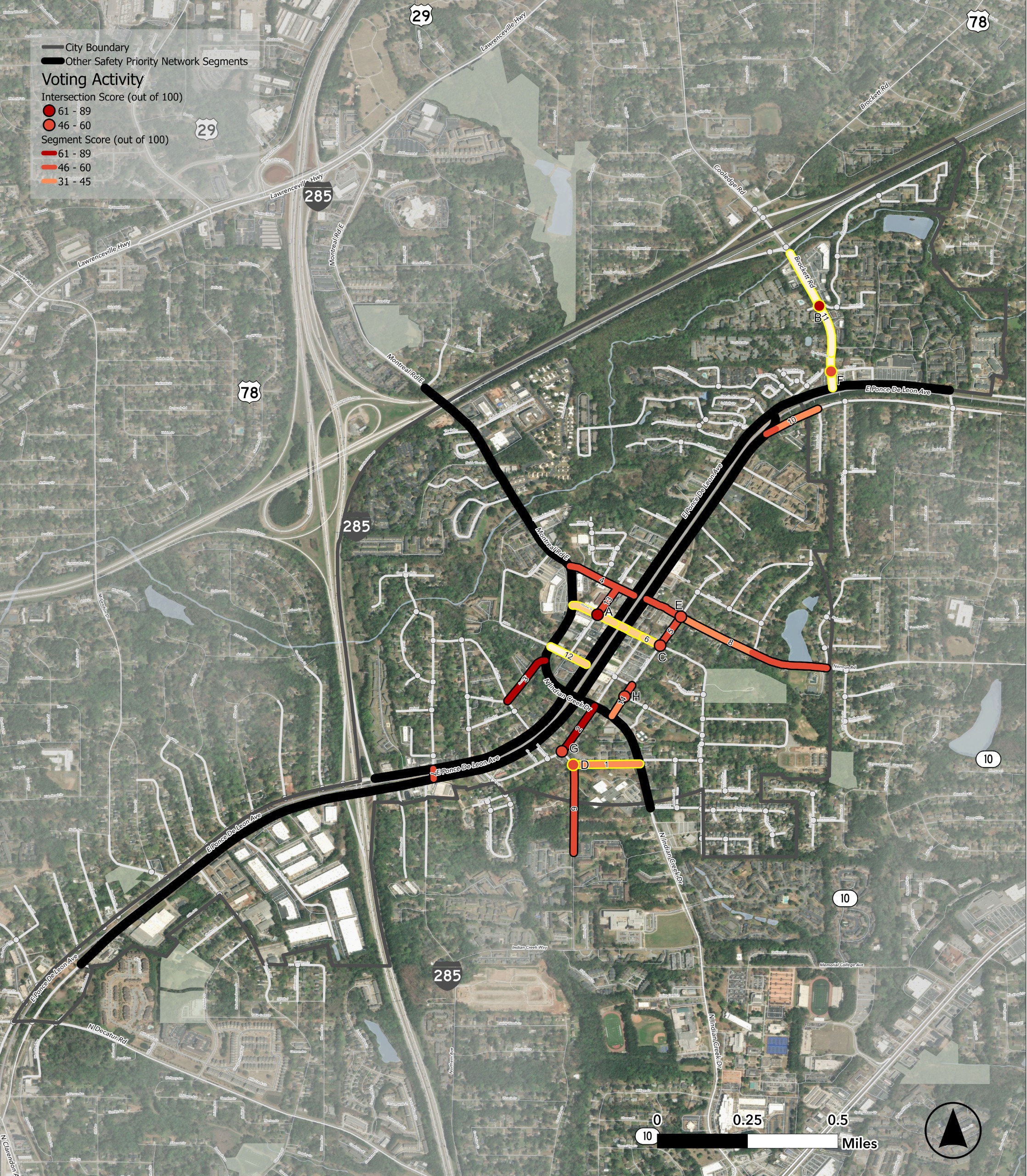
Across Clarkston, several locations have been identified as high priority for locations for safety improvements. Identified road segments are associated with a number on the map below (between 1 - 14) and identified intersections are associated with a letter (between A - H).
Five road segments/intersections currently have recommendations for specific projects. Those 5 locations are shown on the map with blue circles (from north to south):
After clicking on each circle and reviewing the location's suggested improvements, please respond to the questions below about each site.
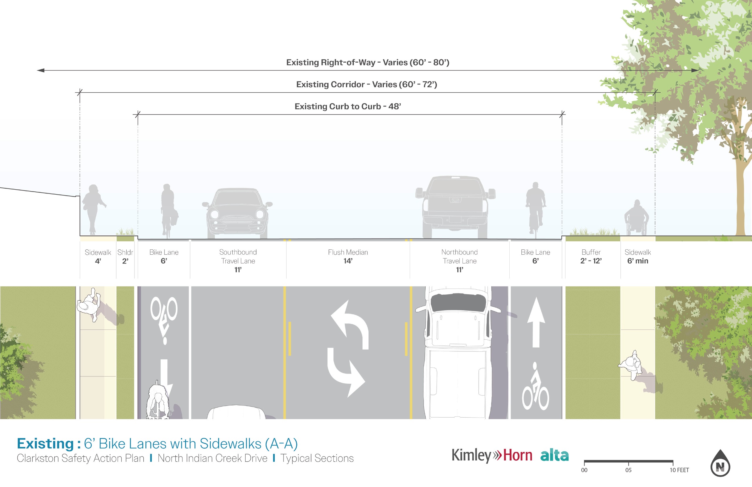
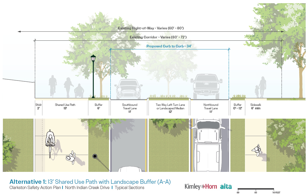
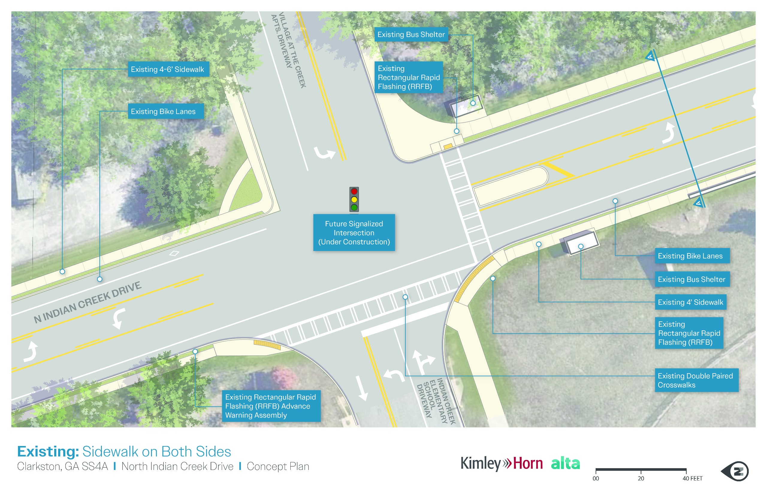
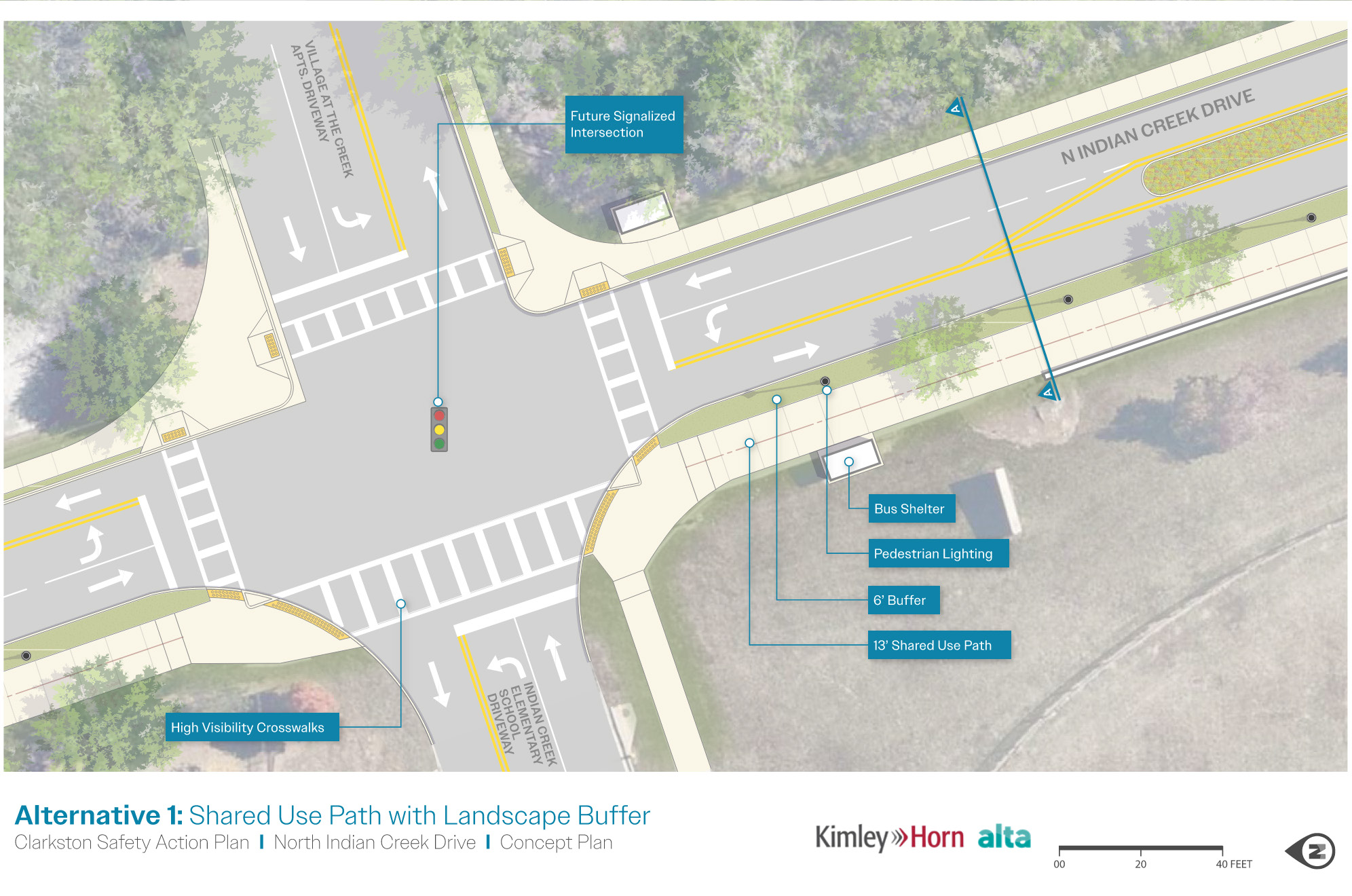
These sets of images depict typical, current corridor conditions on North Indian Creek Drive between Montreal Drive and the City of Tucker's boundary, though not representative of the entire corridor, as well as the preferred alternative for the corridor's design. After using the arrows on the slider to review both the existing conditions and preferred alternatives, please provide feedback below on the alternative.
Along the Montreal Road/North Indian Creek Drive corridor, 6 locations were identified as places where specific safety improvements were most needed. The following 6 locations are shown on the map with red circles (from north to south):
Click on each circle and use the arrows to scroll through photos and information about each location, including existing conditions at the site and suggested improvement. After reviewing the photos and information, please respond to the questions below about each site.